Fichier d’origine (2 000 × 2 000 pixels, taille du fichier : 1,61 Mio, type MIME : image/jpeg)
Ce fichier provient de Wikimedia Commons. Il peut être utilisé par d'autres projets.
Sa description sur sa page de description est affichée ci-dessous.
Description
DescriptionIstanbul Turkey - Envisat.jpg
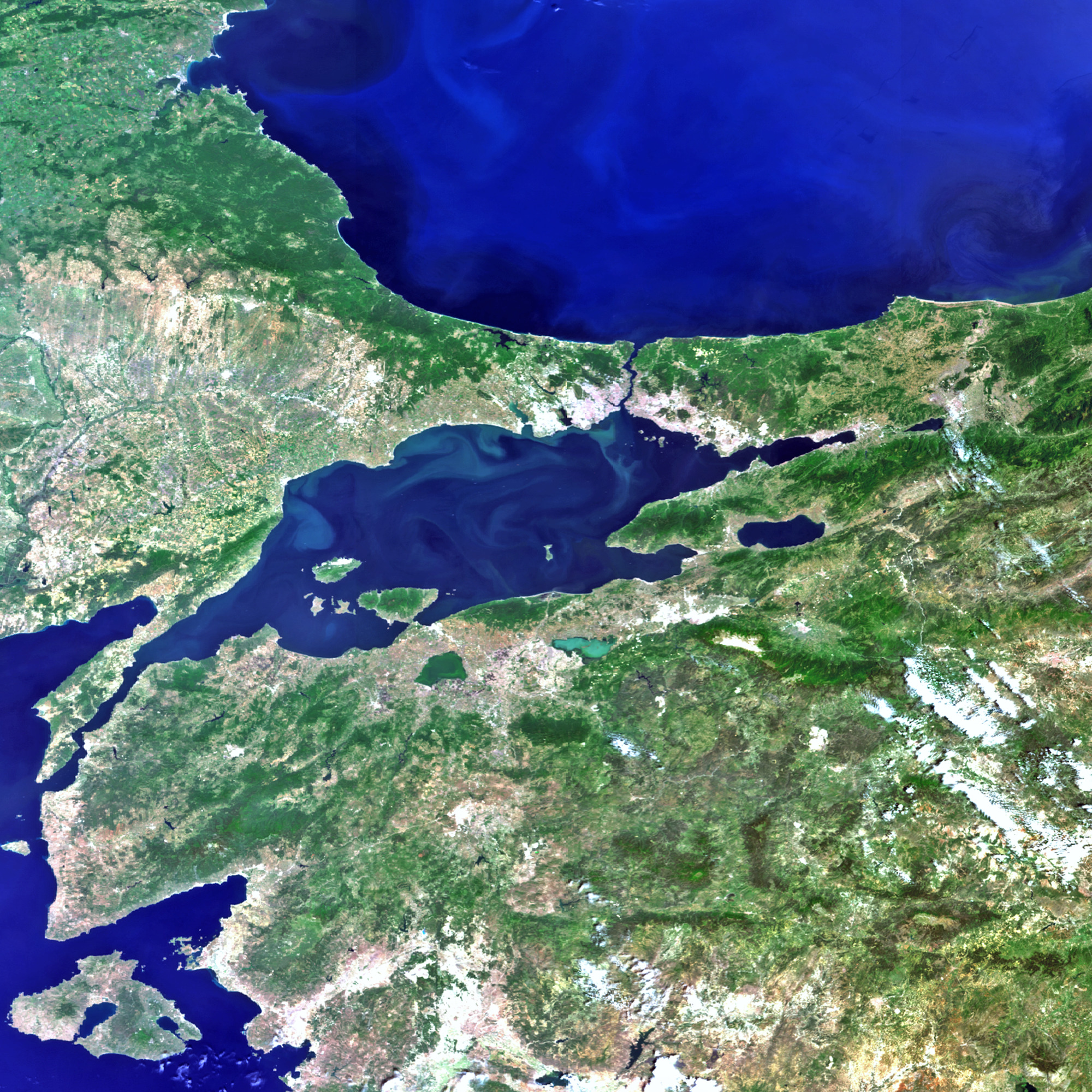
English: Istanbul and the surrounding area in northwestern Turkey are captured in this image acquired by Envisat’s MERIS instrument on 9 June 2011. To the north is the Black Sea, which connects to the Sea of Marmara (centre) via the Bosphorus strait. The Dardanelles strait connects the Marmara to the Aegean Sea (lower left corner). Turkey's largest city, Istanbul, is near the centre of the image at the Bosphorus strait. Istanbul straddles two continents (Europe and Asia), making it a true meeting place of the East and the West.
Turkey’s location makes it vulnerable to earthquakes, with the 1000 km-long North Anatolian fault just 15 km south of Istanbul. Because earthquakes can suddenly render current maps out of date, satellite images are useful for updating views of how the landscape has been affected as well as creating reference cartography for emergency operations. In addition, before and after satellite images of the area enable authoritative damage assessment as a basis for planning remedial action.
de partager – de copier, distribuer et transmettre cette œuvre
d’adapter – de modifier cette œuvre
Sous les conditions suivantes :
paternité – Vous devez donner les informations appropriées concernant l'auteur, fournir un lien vers la licence et indiquer si des modifications ont été faites. Vous pouvez faire cela par tout moyen raisonnable, mais en aucune façon suggérant que l’auteur vous soutient ou approuve l’utilisation que vous en faites.
partage à l’identique – Si vous modifiez, transformez, ou vous basez sur cette œuvre, vous devez distribuer votre contribution sous la même licence ou une licence compatible avec celle de l’original.
=={{int:filedesc}}== {{Photograph |photographer = Envisat satellite |title = Istanbul, Turkey |description = {{en|Istanbul and the surrounding area in northwestern Turkey are captured in this image acquired by Envisat’s M...


