Fichier:Groenland carte.png
Aller à la navigation
Aller à la recherche

Taille de cet aperçu : 279 × 600 pixels. Autres résolutions : 111 × 240 pixels | 329 × 707 pixels.
Fichier d’origine (329 × 707 pixels, taille du fichier : 49 kio, type MIME : image/png)

|
Cette image (de type locator map) devrait être recréée dans un format vectoriel, en tant que fichier SVG. Cela offrirait plusieurs avantages : voir Commons:Media for cleanup pour plus d'informations. Si une version SVG de cette image est déjà disponible, merci de bien vouloir l'envoyer. Après cela, remplacez ce modèle par {{vector version available|nouveau nom d'image.svg}}.
|
Description
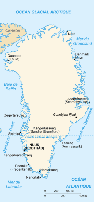
| Description | Map in French of Greenland |
| Date | translation : September 2006 |
| Source | CIA World Factbook |
| Auteur | of the translation : Eric Gaba (Sting) |
| Autorisation (Réutilisation de ce fichier) |
PD |
| Autres versions | original English version : Image:Greenland-CIA_WFB_Map.png |
Français : * Sujet : Carte en français du Groenland ;
- Source : CIA World Factbook ;
- Autre version disponible : anglophone : Image:Greenland-CIA_WFB_Map.png
- Auteur de la traduction : Eric Gaba (fr:Sting) ;
- Date : Septembre 2006.
Conditions d’utilisation
Cette image est dans le domaine public parce que son contenu provient du World Factbook, édité par la Central Intelligence Agency des États-Unis d’Amérique.
|
 |
| This work was previously under Public Domain, or a Free License. It has been digitally enhanced and/or modified. This derivative work has been (or is hereby) released into the public domain by its author, Sting at the French Wikipedia project. This applies worldwide. In some countries this is not legally possible; if so:
|
Historique du fichier
Cliquer sur une date et heure pour voir le fichier tel qu'il était à ce moment-là.
| Date et heure | Vignette | Dimensions | Utilisateur | Commentaire | |
|---|---|---|---|---|---|
| Actuel | 30 septembre 2006 à 15:56 | | 329 × 707 (49 kio) | wikimediacommons>Sting | {{Information |Description=Map in French of Greenland |Source=[https://www.cia.gov/cia/publications/factbook/index.html CIA World Factbook] |Date=translation : September 2006 |Author=of the translation : Eric Gaba (Sting) |Permission=PD |ot |
Utilisation du fichier
La page suivante utilise ce fichier :