Fichier:TAAF-CIA WFB Map.png
Aller à la navigation
Aller à la recherche

Taille de cet aperçu : 466 × 599 pixels. Autres résolutions : 187 × 240 pixels | 373 × 480 pixels | 690 × 887 pixels.
Fichier d’origine (690 × 887 pixels, taille du fichier : 49 kio, type MIME : image/png)
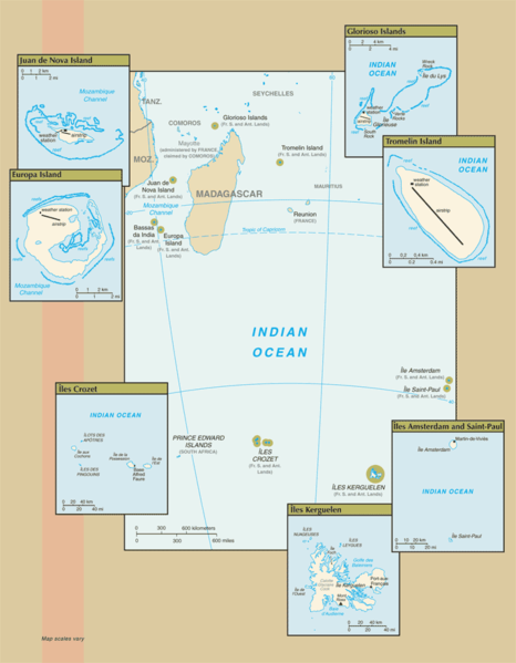
Map of the French Southern and Antarctic Lands, from CIA.gov
Cette image est dans le domaine public parce que son contenu provient du World Factbook, édité par la Central Intelligence Agency des États-Unis d’Amérique.
|
 |
Historique du fichier
Cliquer sur une date et heure pour voir le fichier tel qu'il était à ce moment-là.
| Date et heure | Vignette | Dimensions | Utilisateur | Commentaire | |
|---|---|---|---|---|---|
| Actuel | 25 juillet 2007 à 12:14 | | 690 × 887 (49 kio) | wikimediacommons>Hoshie | Updated map of the French Southern and Antarctic Lands from the CIA World Factbook, 19 July 07 rev. Src: https://www.cia.gov/library/publications/the-world-factbook/maps/fs-map.gif |
Utilisation du fichier
Aucune page n’utilise ce fichier.