Fichier:C72189s1 Ant.Map Cape Hallet.jpg
Aller à la navigation
Aller à la recherche

Taille de cet aperçu : 712 × 599 pixels. Autres résolutions : 285 × 240 pixels | 570 × 480 pixels | 912 × 768 pixels | 1 216 × 1 024 pixels | 2 432 × 2 048 pixels | 3 860 × 3 250 pixels.
Fichier d’origine (3 860 × 3 250 pixels, taille du fichier : 2,26 Mio, type MIME : image/jpeg)
Description
| Description |
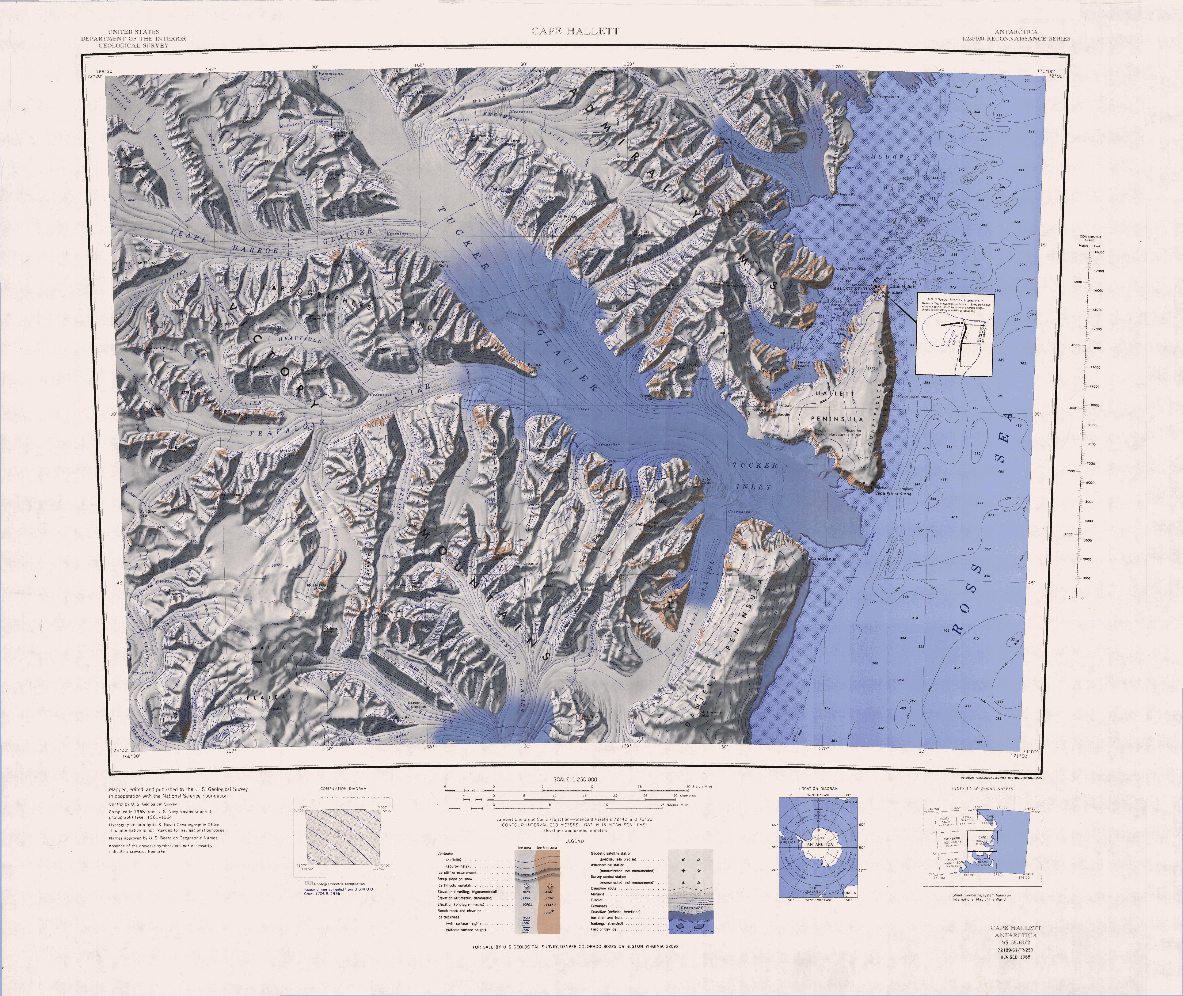
English: 1:250,000-scale topographic reconnaissance map of the Cape Hallet area from 159°-162°E to 71°-72°S in Antarctica, including the Tucker Glacier. Mapped, edited and published by the U.S. Geological Survey in cooperation with the National Science Foundation. |
|||
| Date | ||||
| Source | http://usarc.usgs.gov/drg_dload.shtml | |||
| Auteur | United States Geological Survey | |||
| Autorisation (Réutilisation de ce fichier) |
|
|||
| Autres versions | Œuvres dérivées de ce fichier : Latino Peak.jpg |
Historique du fichier
Cliquer sur une date et heure pour voir le fichier tel qu'il était à ce moment-là.
| Date et heure | Vignette | Dimensions | Utilisateur | Commentaire | |
|---|---|---|---|---|---|
| Actuel | 3 avril 2005 à 19:40 | | 3 860 × 3 250 (2,26 Mio) | wikimediacommons>Achim Raschka | Map of Antarctica by the United States Antarctic Ressource Center of the US Geological Society. {{PD-US}} Copyrights and Trademarks USGS-authored or produced data and information are in the public domain. While the content of most USGS web pages is in th |
Utilisation du fichier
Aucune page n’utilise ce fichier.