Fichier:Virgin Islands-map-CIA.jpg
Aller à la navigation
Aller à la recherche


Taille de cet aperçu : 407 × 599 pixels. Autres résolutions : 163 × 240 pixels | 326 × 480 pixels | 522 × 768 pixels | 1 036 × 1 525 pixels.
Fichier d’origine (1 036 × 1 525 pixels, taille du fichier : 138 kio, type MIME : image/jpeg)
Description
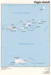
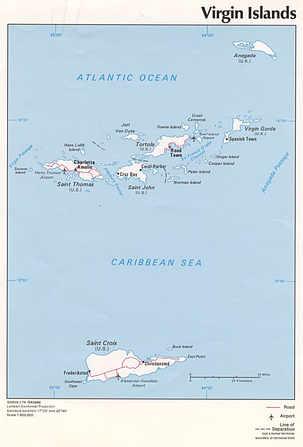
| Description | Political map of U.S. Virgin Islands and British Virgin Islands, 1976, produced by the U.S. Central Intelligence Agency. |
| Date | |
| Source | University of Texas Libraries, Perry-Castañeda Library Map Collection: Americas Maps |
| Auteur | CIA |
| Autres versions |
|

Conditions d’utilisation
| Cette image est une œuvre d'un employé de la Central Intelligence Agency, réalisée dans le cadre des tâches officielles de cette personne. En tant qu’œuvre du Gouvernement des États-Unis d'Amérique, ce document est placé dans le domaine public aux États-Unis d'Amérique.
|

|
Historique du fichier
Cliquer sur une date et heure pour voir le fichier tel qu'il était à ce moment-là.
| Date et heure | Vignette | Dimensions | Utilisateur | Commentaire | |
|---|---|---|---|---|---|
| Actuel | 3 juillet 2005 à 12:02 | | 1 036 × 1 525 (138 kio) | wikimediacommons>Kooma | CIA map of U.S. Virgin Islands and British Virgin Islands from [http://www.lib.utexas.edu/maps/americas/virginislands.jpg]. {{PD-USGov-CIA}} Category:Caribbean |
Utilisation du fichier
La page suivante utilise ce fichier :