Fichier:LocationBritishVirginIslands.svg
Aller à la navigation
Aller à la recherche


Taille de cet aperçu PNG pour ce fichier SVG : 800 × 320 pixels. Autres résolutions : 320 × 128 pixels | 640 × 256 pixels | 1 024 × 410 pixels | 1 280 × 512 pixels | 2 560 × 1 024 pixels | 1 750 × 700 pixels.
Fichier d’origine (Fichier SVG, nominalement de 1 750 × 700 pixels, taille : 324 kio)

|
Il existe une version matricielle de cette image.
File:LocationBritishVirginIslands.svg → File:LocationBritishVirginIslands.png
Pour plus d’informations sur les images vectorielles, consultez Aide:SVG. |
Description
| Description |
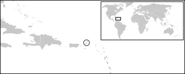
English: Location map for British Virgin Islands. Vectorised version of Image:LocationBritishVirginIslands.png |
| Date | (UTC) |
| Source |
Cette image vectorielle non W3C-spécifiée a été créée avec Inkscape . |
| Auteur |
|
Conditions d’utilisation
| Cette image a été retouchée, ce qui signifie qu'elle a été modifiée par ordinateur et est différente de l'image d'origine. Liste des modifications : Combined two maps to form a newly vectorised version of the British Virgin Islands map. L'image d'origine se trouve ici : BlankMap-Caribbean.svg:
|
| Moi, propriétaire des droits d’auteur sur cette œuvre, la place dans le domaine public. Ceci s'applique dans le monde entier. Dans certains pays, ceci peut ne pas être possible ; dans ce cas : J’accorde à toute personne le droit d’utiliser cette œuvre dans n’importe quel but, sans aucune condition, sauf celles requises par la loi. |
Journal des téléversements d’origine
This image is a derivative work of the following images:
- File:BlankMap-World-v2.svg licensed with PD-self
- 2011-03-27T23:08:42Z Wayiran 1243x564 (209452 Bytes) Some correction on North-west border of Iran's map + south of Caspian sea
- 2008-12-03T18:02:36Z Harbin 1326x601 (192122 Bytes)
- 2008-12-02T19:55:14Z Harbin 1326x601 (197882 Bytes)
- 2008-12-02T19:04:59Z Harbin 1326x601 (176022 Bytes) {{Information |Description={{en|1=A blank map of the world as of 2005, with country outlines. Sovereign microstates less than 2 500 km² in area are depicted as circles (see Wikipedia:Image_talk:BlankMap-World-v2.png for list
- File:BlankMap-Caribbean.svg licensed with PD-self
- 2010-09-20T02:01:50Z NuclearVacuum 896x633 (274735 Bytes) new version
- 2010-02-23T15:29:09Z NuclearVacuum 2201x1507 (214283 Bytes) cleanup
- 2010-02-11T19:26:10Z NuclearVacuum 2201x1507 (211807 Bytes) I have started from scratch and made a completely new map of the Caribbean. This current version has an invalid code, but I will work on that later.
- 2009-09-22T00:08:34Z NuclearVacuum 940x477 (252618 Bytes) {{Information |Description={{en|1=Map of the [[:en:Caribbean|Caribbean nations]].}} |Source=[[:File:BlankMap-World6.svg]]{{Inkscape}} |Author=[[User:NuclearVacuum|NuclearVacuum]] |Date=2009-09-21 |Permission= |other_versions=
Téléversé avec derivativeFX
Historique du fichier
Cliquer sur une date et heure pour voir le fichier tel qu'il était à ce moment-là.
| Date et heure | Vignette | Dimensions | Utilisateur | Commentaire | |
|---|---|---|---|---|---|
| Actuel | 30 juin 2011 à 04:08 | 1 750 × 700 (324 kio) | wikimediacommons>Maky | {{Bitmap version available|LocationBritishVirginIslands.png}} {{Information |Description={{en|1=Location map for British Virgin Islands.<br> Vectorised version of Image:LocationBritishVirginIslands.png}} |Source=*File:BlankMap-World-v2.svg |
Utilisation du fichier
La page suivante utilise ce fichier :