Fichier:Caucasus topographic map-fr.svg.png
Aller à la navigation
Aller à la recherche

Pas de plus haute résolution disponible.
Caucasus_topographic_map-fr.svg.png (771 × 599 pixels, taille du fichier : 707 kio, type MIME : image/png)
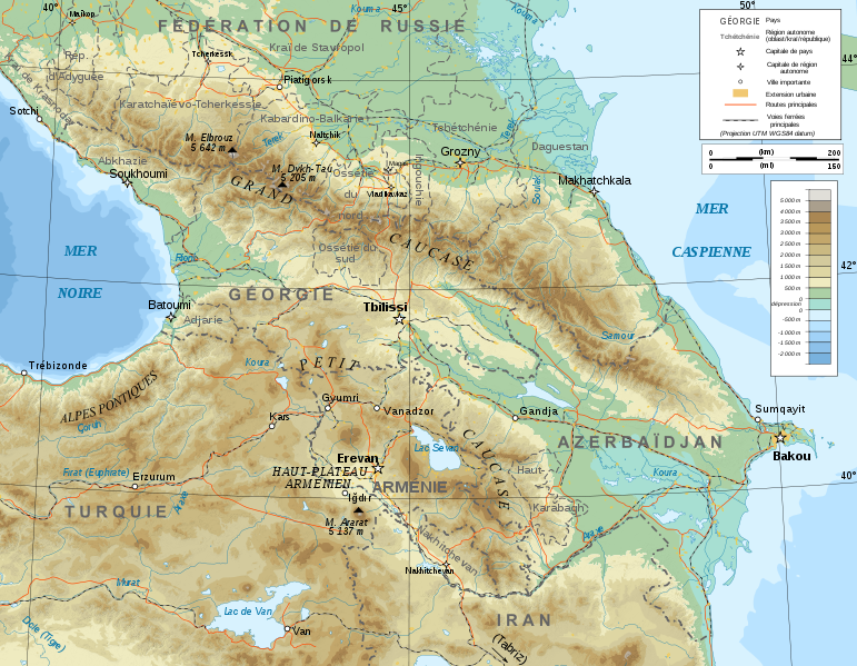
| Description |
Carte topographique du Caucase. | ||
|---|---|---|---|
| Source(s) |
| ||
| Licence(s) |
| ||
| Auteur(s) |
Bourrichon | ||
| Date(s) |
2008 |
Historique du fichier
Cliquer sur une date et heure pour voir le fichier tel qu'il était à ce moment-là.
| Date et heure | Vignette | Dimensions | Utilisateur | Commentaire | |
|---|---|---|---|---|---|
| Actuel | 26 juin 2011 à 23:17 | | 771 × 599 (707 kio) | Ptyx (discussions | contributions) | {{Information image | Description = Carte topographique du Caucase. | Source = {{Commons|Caucasus_topographic_map-fr.svg.png}} | Licence = {{CC-BY-SA-3.0,2.5,2.0,1.0}} | Auteur = Bourrichon | Date = 2008 }} [[Catégorie:Image Ca |
Tu ne peux pas remplacer ce fichier.
Utilisation du fichier
Les 2 pages suivantes utilisent ce fichier :