Les lecteurs de Vikidia demandent des articles en plus. Voyez la liste d'articles à créer, et venez nous aider à les rédiger !
Catégorie:Image carte géographique
Aller à la navigation
Aller à la recherche
Sous-catégories
Cette catégorie comprend 11 sous-catégories, dont les 11 ci-dessous.
A
E
I
O
P
Média dans la catégorie « Image carte géographique »
Les 28 fichiers suivants figurent dans cette catégorie, sur un total de 28.
 Atlas Cosmographicae (Mercator) b 005.jpg 2 921 × 4 761 ; 3,3 Mio
 Bassin de la Meuse.jpg 396 × 600 ; 106 kio
 Casiquiarerivermap.png 1 500 × 1 500 ; 974 kio
 Climats d'Europe.JPG 957 × 893 ; 317 kio
 Colonies britanniques d'Amérique du Nord en 1775.jpg 458 × 599 ; 136 kio
 Corrientes-oceanicas.gif 1 000 × 522 ; 75 kio
 Détroit de Béring.jpg 800 × 430 ; 229 kio
 Gironde-ATMO export-cartographie.png 644 × 754 ; 712 kio
 Guyane map-fr.svg 1 183 × 1 427 ; 907 kio
 Géo physique Madagascar.jpg 528 × 886 ; 249 kio
 Ionian-Islands.jpg 337 × 397 ; 44 kio
 Lake Titicaca map-fr.png 433 × 434 ; 21 kio
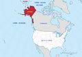 Localisation Alaska.jpg 800 × 561 ; 151 kio
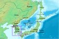 Localisation Corée du Sud.jpg 800 × 524 ; 284 kio
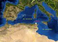 Localisation de Bizerte.jpg 709 × 515 ; 136 kio
 Malte-localisation.jpg 569 × 290 ; 241 kio
 Marquesas map-fr.svg 4 357 × 4 301 ; 3,09 Mio
 Middle East (orthographic projection).svg 553 × 553 ; 328 kio
 New Caledonia and Vanuatu bathymetric and topographic map-fr.jpg 2 980 × 2 090 ; 1,53 Mio
 Ocan Indien.jpg 528 × 528 ; 96 kio
 Pelagie Islands map.png 596 × 705 ; 91 kio
 Plates tect2 fr.svg 4 217 × 3 169 ; 171 kio
 Relief de l'Irlande.jpg 481 × 600 ; 151 kio
 Sarthe.jpg 659 × 600 ; 248 kio
 Sèvre nantaise.jpg 659 × 600 ; 248 kio
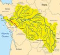
 Sénégal drainage basin map-fr.svg 1 296 × 830 ; 3,53 Mio
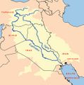 Tigre-euphrate.jpg 597 × 600 ; 105 kio
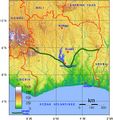 Topographie-villes- Côte-d'Ivoire.jpg 565 × 600 ; 195 kio
_b_005.jpg)


.svg)


