Fichier:Galapagos-satellite-2002.jpg
Aller à la navigation
Aller à la recherche

Taille de cet aperçu : 800 × 600 pixels. Autres résolutions : 320 × 240 pixels | 640 × 480 pixels | 1 024 × 768 pixels | 1 280 × 960 pixels | 1 600 × 1 200 pixels.
Fichier d’origine (1 600 × 1 200 pixels, taille du fichier : 387 kio, type MIME : image/jpeg)
Description
| Description |
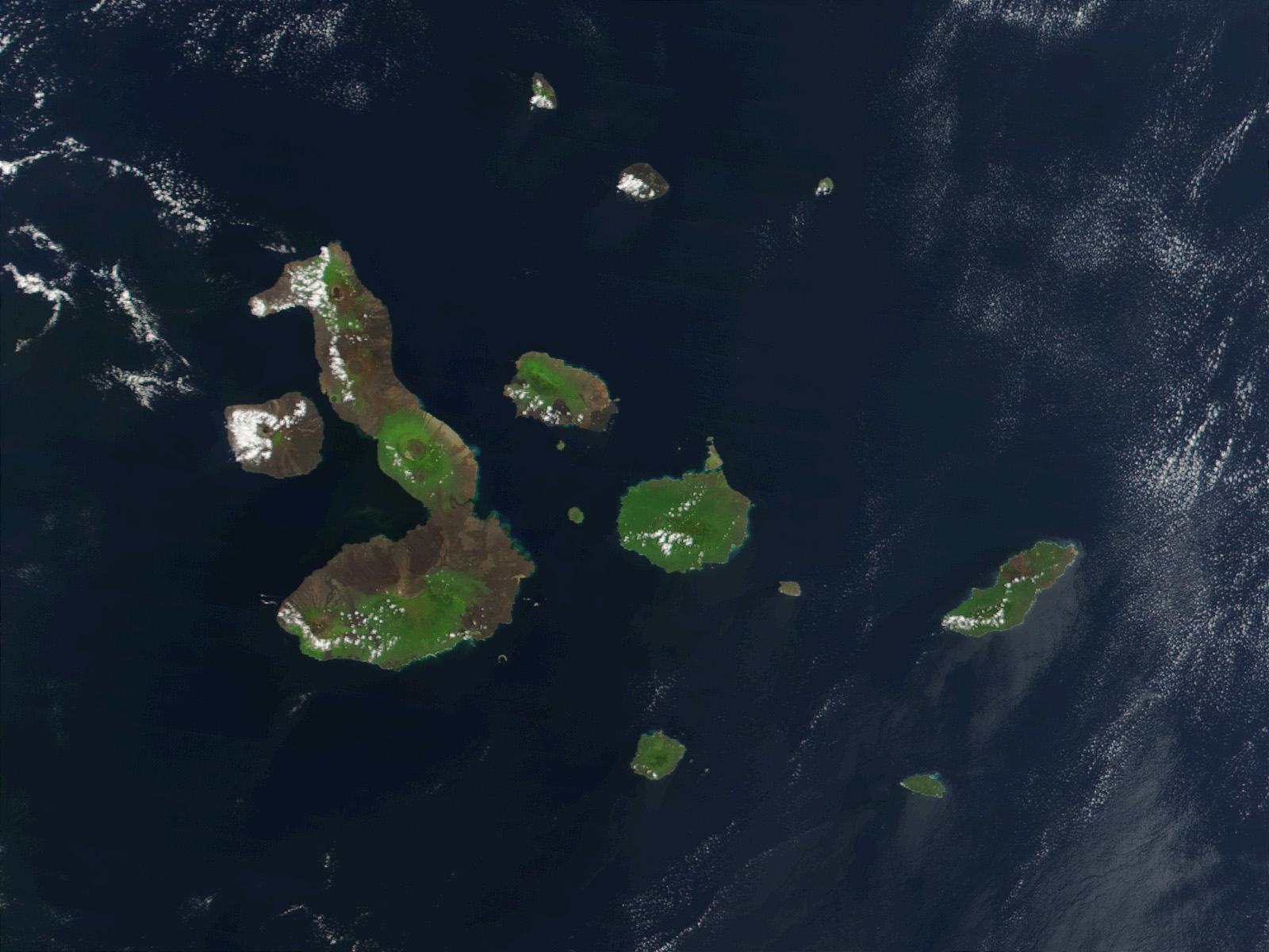
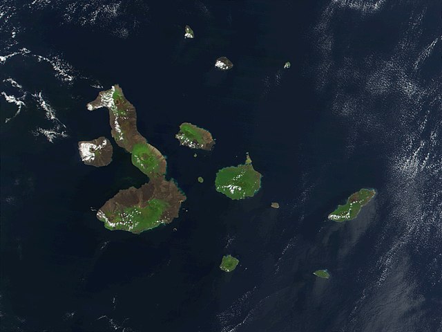
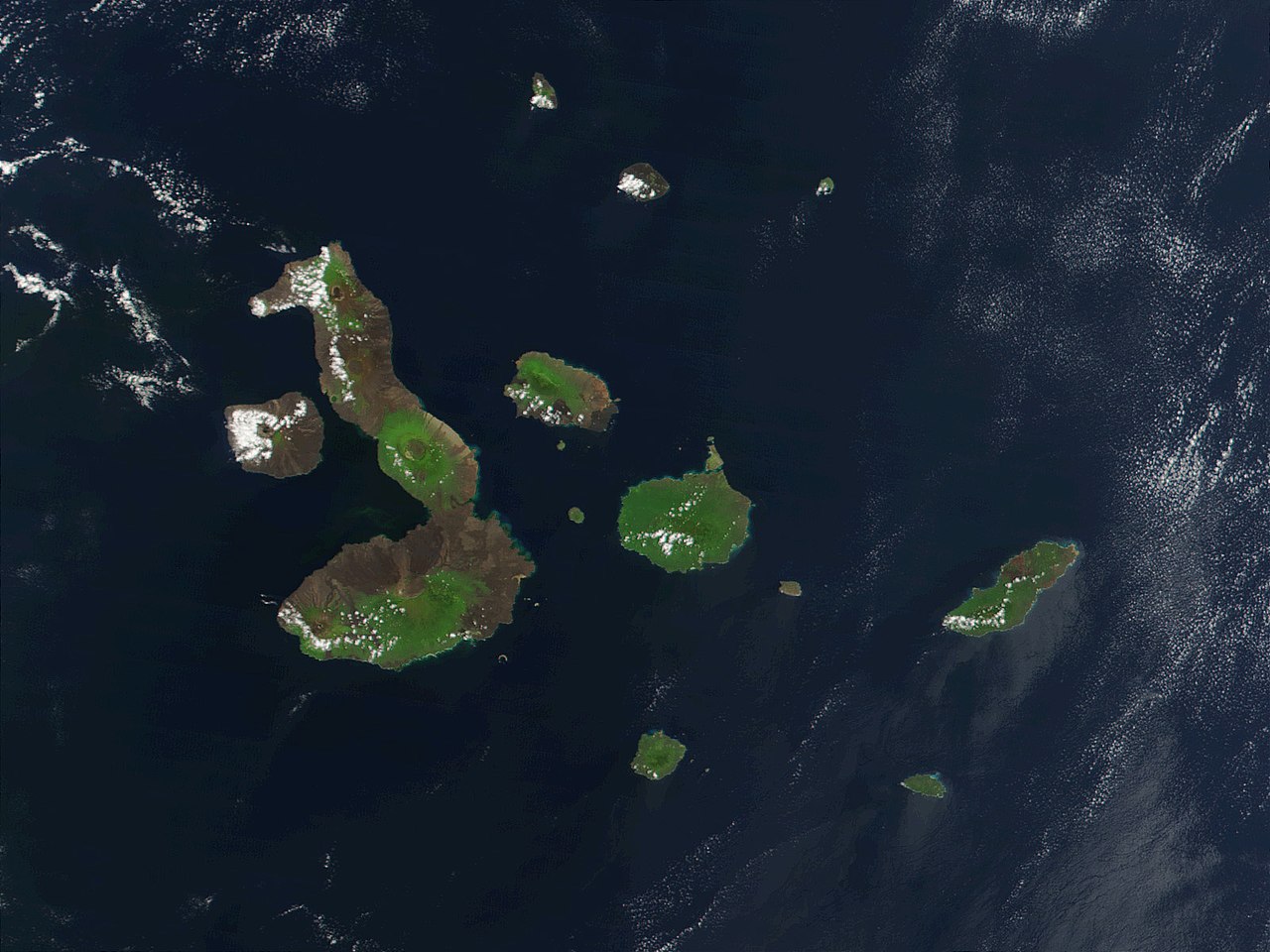
English: This true-color image of the Galapagos Islands was acquired on March 12, 2002, by the Moderate-resolution Imaging Spectroradiometer (MODIS), flying aboard NASA's Terra satellite. The Galapagos Islands, which are part of Ecuador, sit in the Pacific Ocean about 1000 km (620 miles) west of South America. As the three craters on the largest island (Isabela Island) suggest, the archipelago was created by volcanic eruptions, which took place millions of years ago. |
| Date | |
| Source | Earth Observatory 8270 and NASA GSFC |
| Auteur | Jacques Descloitres, MODIS Rapid Response Project at NASA/GSFC |
Conditions d’utilisation
| Ce fichier provient de la NASA. Sauf exception, les documents créés par la NASA ne sont pas soumis à copyright. Pour plus d'informations, voir la politique de copyright de la NASA. | ||
 |
Attention :
|
| Annotations | Cette image est annotée : Voir les annotations sur Wikimedia Commons |
Historique du fichier
Cliquer sur une date et heure pour voir le fichier tel qu'il était à ce moment-là.
| Date et heure | Vignette | Dimensions | Utilisateur | Commentaire | |
|---|---|---|---|---|---|
| Actuel | 25 novembre 2007 à 23:13 | | 1 600 × 1 200 (387 kio) | wikimediacommons>CarolSpears | {{Information |Description= This true-color image of the Galapagos Islands was acquired on March 12, 2002, by the Moderate-resolution Imaging Spectroradiometer (MODIS), flying aboard NASA's Terra satellite. The Galapagos Islands, which are part of Ecuador |
Utilisation du fichier
Aucune page n’utilise ce fichier.